Project Description

An optimized sampling plan to assess the volumes of contaminated backfills
Sampling plans of polluted soils can be optimized to account for the spatial distribution of contamination – which is case-specific – and meet the objectives of the investigation stage.
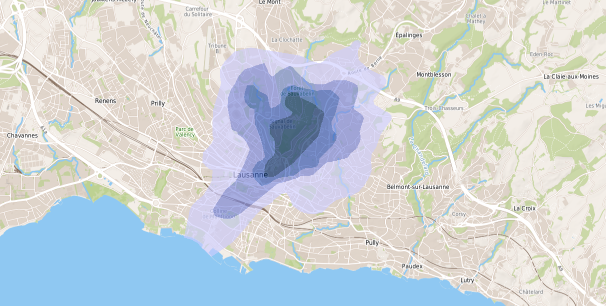
Such an optimization could be applied to a site in Lausanne thanks to an exemplary collaboration between the contaminated sites specialists of Institut Géotechnique and eOde. Institut Géotechnique consulted us very early in the project, before starting the investigation work of a site including polluted backfills. It was thus possible to give advice on the number and location of the boreholes and soil samples – to assess the volumes of contaminated backfills in good conditions. This work allowed to signicantly reduce the cost and time for earthwork and site clean up operations, and to facilitate their management.
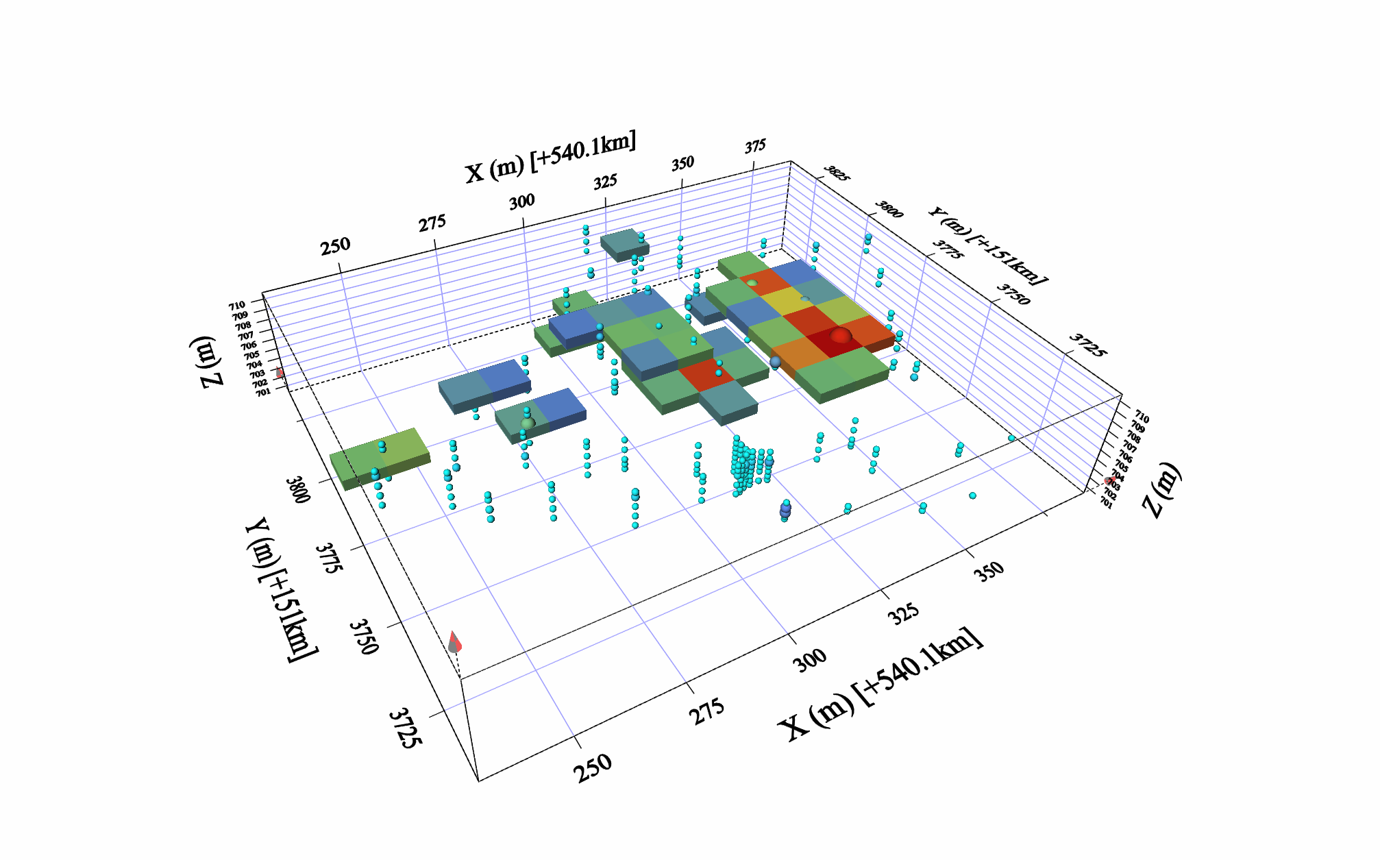
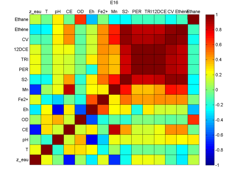
One of the major question concerned the spatial distribution of contamination : was it very heterogeneous, close to a purely random phenomenon, or was there any spatial continuity that allowed to estimate the volumes with good accuracy ? The first situation could not be excluded, given the type of soil, made of backfills of various origins. It would then lead ineluctably to a very uncertain volume estimation, whatever the number of boreholes and soil samples.
A 2-stages investigation was then conducted. The first stage was small with the goal to assess if contamination was purely heterogeneous or spatially continuous. In case of complete randomness, investigation would have been stopped at this early stage. The second stage was larger, to detail the spatial distribution of contamination in the whole area.
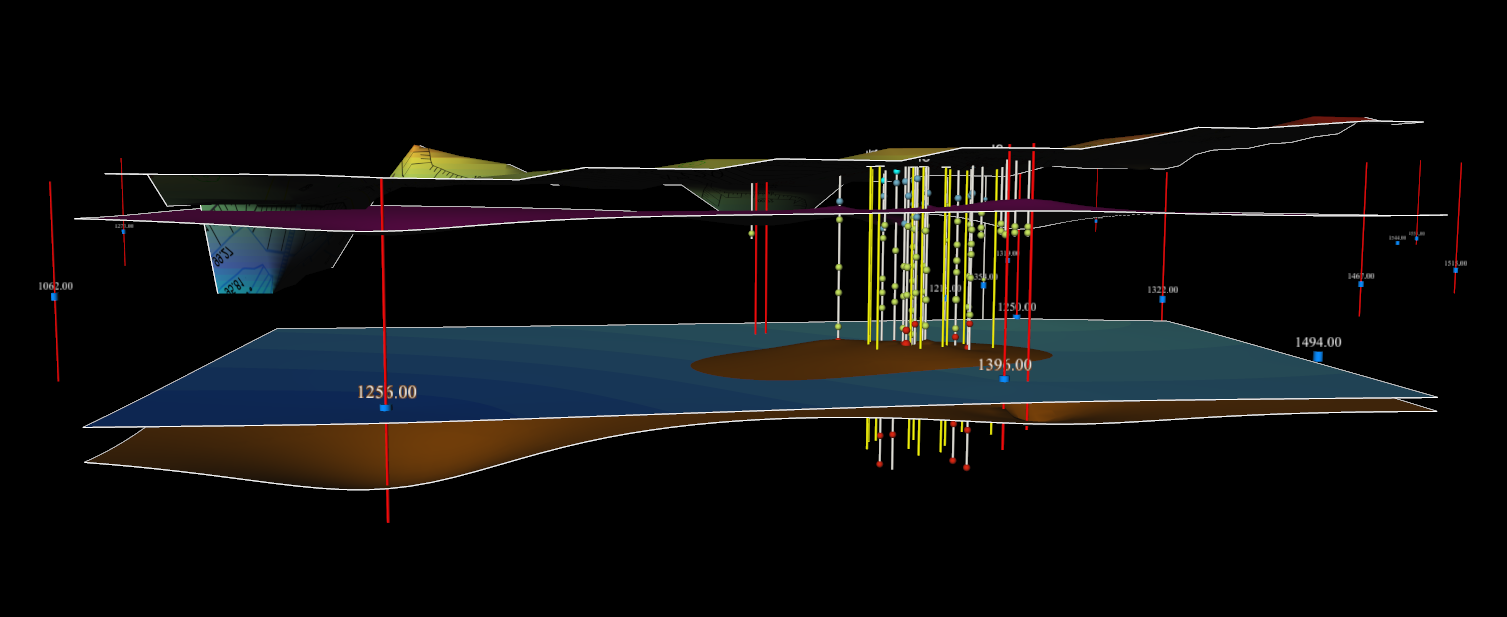
Thereafter, data collected during the 2 investigation steps were analyzed to build a geostatistical model of soil contamination. The model provided both an estimate of the volume of backfills whose pollutant concentrations exceeded the landfills acceptance levels, with confidence intervals ; and the delineation of the polluted zone to dig up, according to the risk of classification error that the site owner or the authority was ready to accept.
The contamination modeling work was coordinated with the work of Institut Géotechnique, involving the geological modeling and the establishment of detailed earthwork plans.