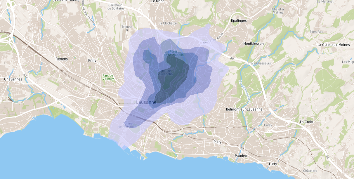
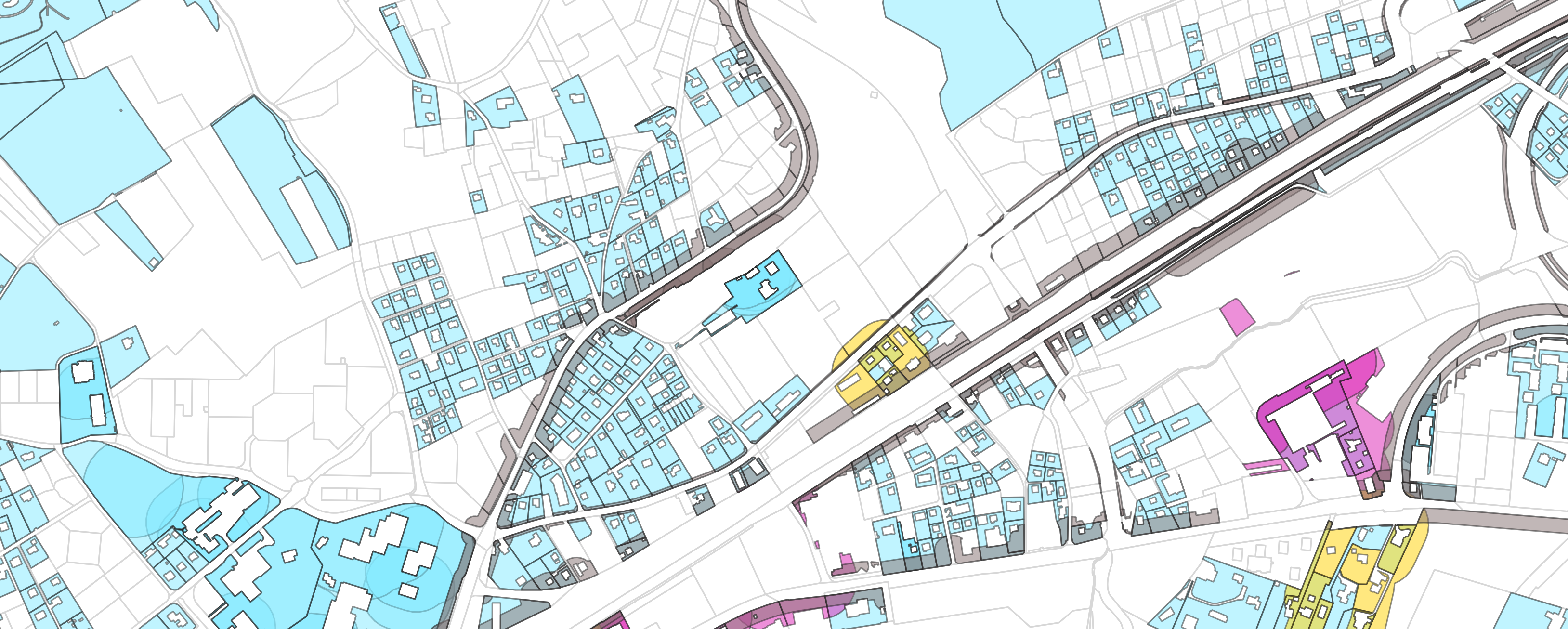
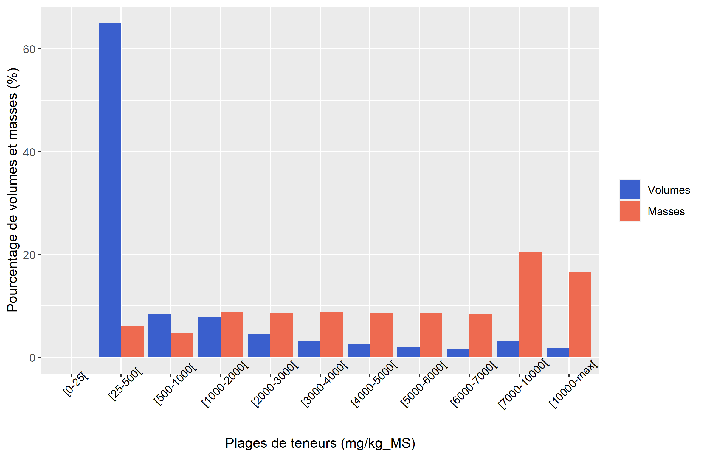
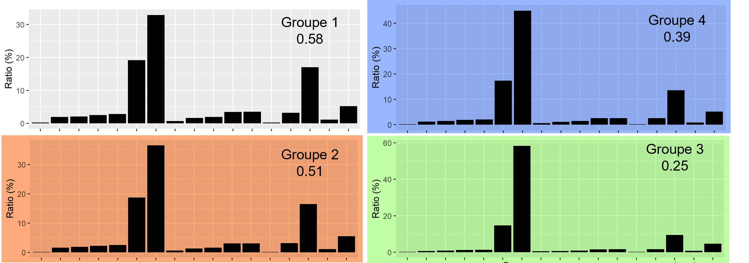
In 2021, we have been mandated by the canton of Vaud to map the potential for dioxin and furan soil pollution in the commune of Lausanne and its neighboring communes. We have modeled the spatial distribution of the pollution from soil samples collected by Impact-Concept, as well as from other data collected by the canton of Vaud and the commune of Lausanne. The geostatistical model obtained reflects the combined effect of the various phenomena that led to the current state of pollution of the old, undisturbed soils: dioxin and furan levels decrease as the distance to the Vallon neighborhood increases, with greater dispersion in the SW-NE direction of the prevailing winds, tempered by the barrier effect that the uneven relief of the sector constitutes in places. The model is consistent with the suspected origin of the pollution, by aerial dissemination in the form of gas or dust from the emission points (chimneys) of old factories located in the Vallon neighborhood. The map delivered represents the classification of the surface soils in the most probable content intervals, and it is on this basis that the canton of Vaud – supported by the university center of general medicine and public health (Unisanté) – was able to establish a health recommendation map for the population.