eOde is a historical protagonist of geostatistics applied to contaminated sites and soil, with a 15 years active participation in the setting up of pragmatic methods suitable to the reality of contaminated sites assessment and remediation in France and Switzerland. Involvement in various actions :
- Creating of GeoSiPol – workshop for promoting the use of geostatistics for assessing site contaminations
- Writing fact sheets and a methodological handbook for GeoSiPol
- Critical feedback on 15 years of geostatistics applied to contaminated sites for RECORD
- Feedback on the predictions of soil quantities requiring remerdiation for 23 former industrial sites for RECORD
- Review of the chapter dedicated to geostatistics in the UPDS handbook on toxic hotspots
- Numerous training sessions for contaminated sites specialists (CAS SIPOL, Aquaconsoil 2015, eOde-Geovariances workshops, etc.).
eOde designs sampling plans, estimates volumes of contaminated soil from investigation data, evaluates the initial pollutant stock and the final residual contamination after an in situ treatment. eOde provides also tailored support to the consulting offices for their own geostatistical studies.
eOde is engaged in the development of new methodologies through various applied research projects, such as REPERAGE or CARTORISK.
Faced with the growing acquisition of large amounts of data, eOde is increasingly involved in a wide range of activities related to environmental data analysis, from data processing and mapping, up to make data available through web services.
Software and computer languages used by eOde : Matlab, R, Isatis, AR2Tech-SgeMs, QGis.
Projects
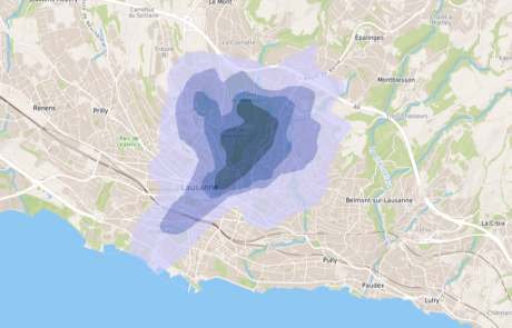
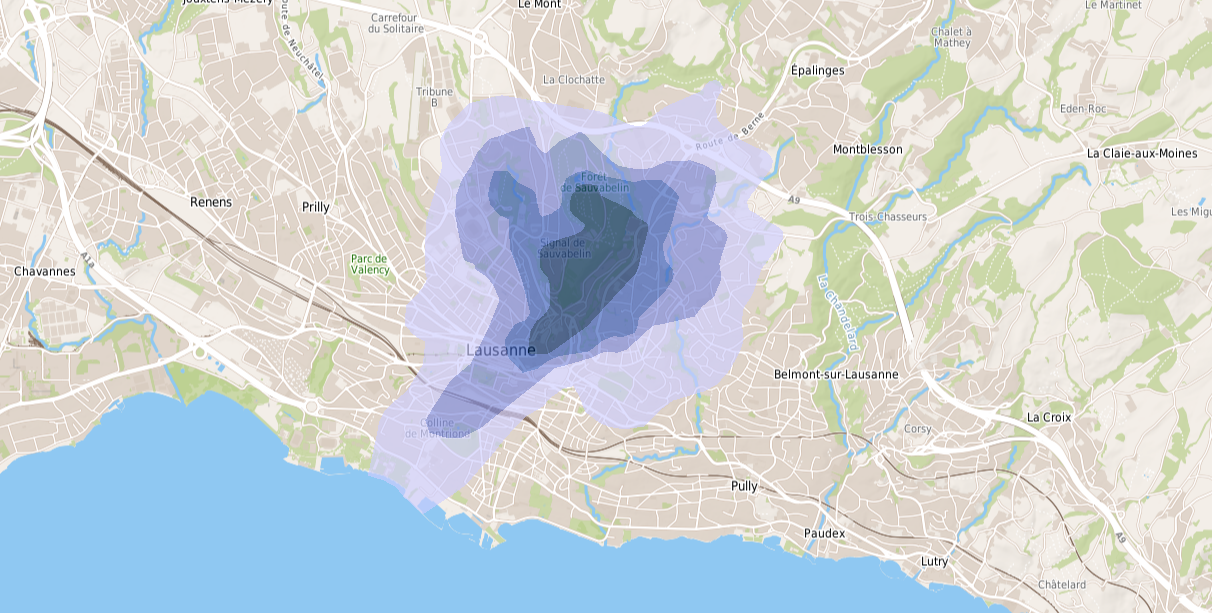
Mapping of dioxin and furan soil pollution in Lausanne in 2021
A geostatistical model as a basis for the health recommendation maps issued by the canton of Vaud for the population
FGU – Determination of normal background concentrations in urban and peri-urban soils in France
A national project to define distributions and map normal background values in soils of the cities and their periphery
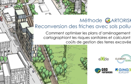
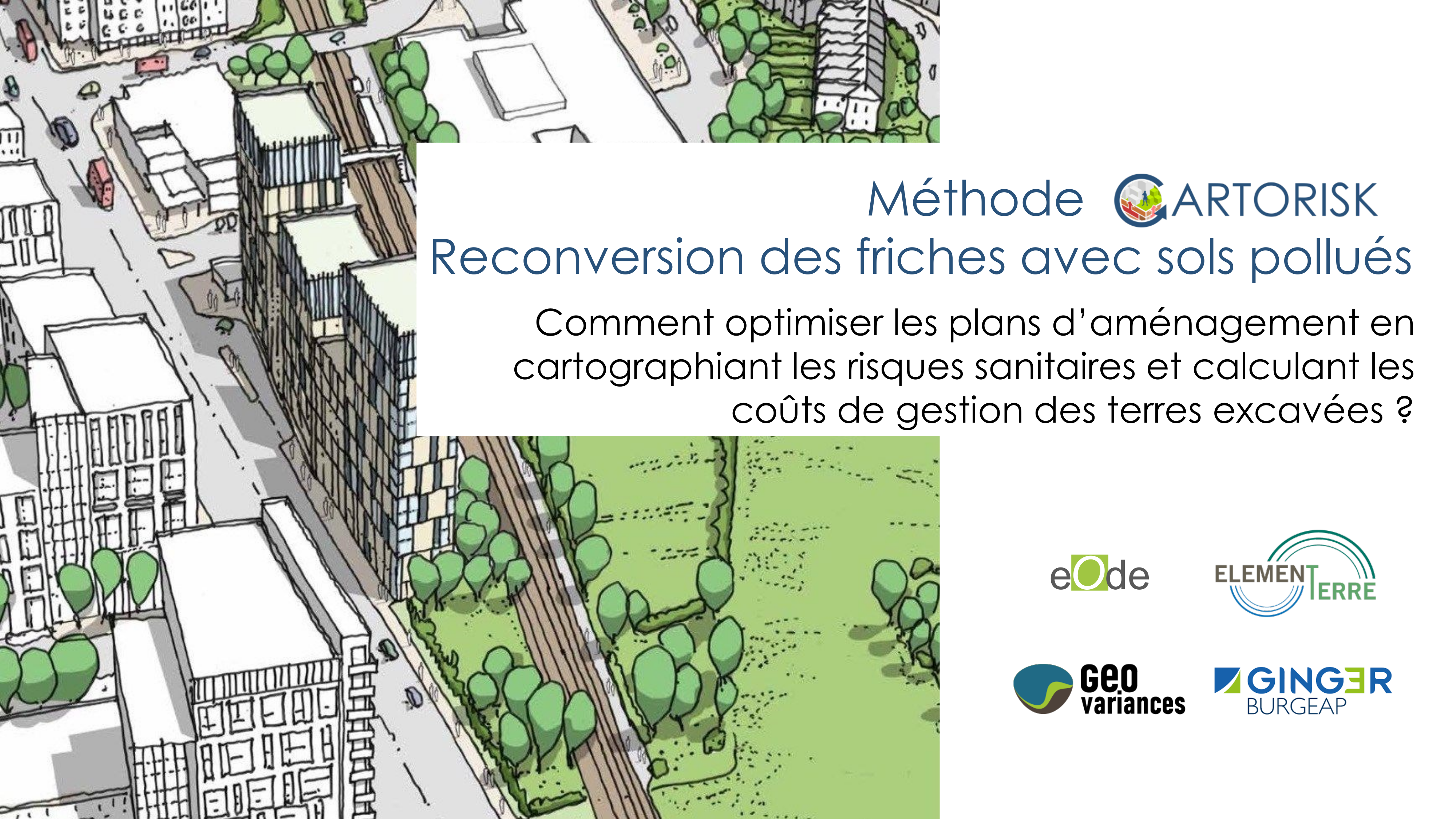
CARTORISK – Geostatistical mapping of health risks
An innovation project to develop a method for health risks mapping and define its implementation in the decision process of brownfields redevelopment
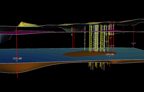
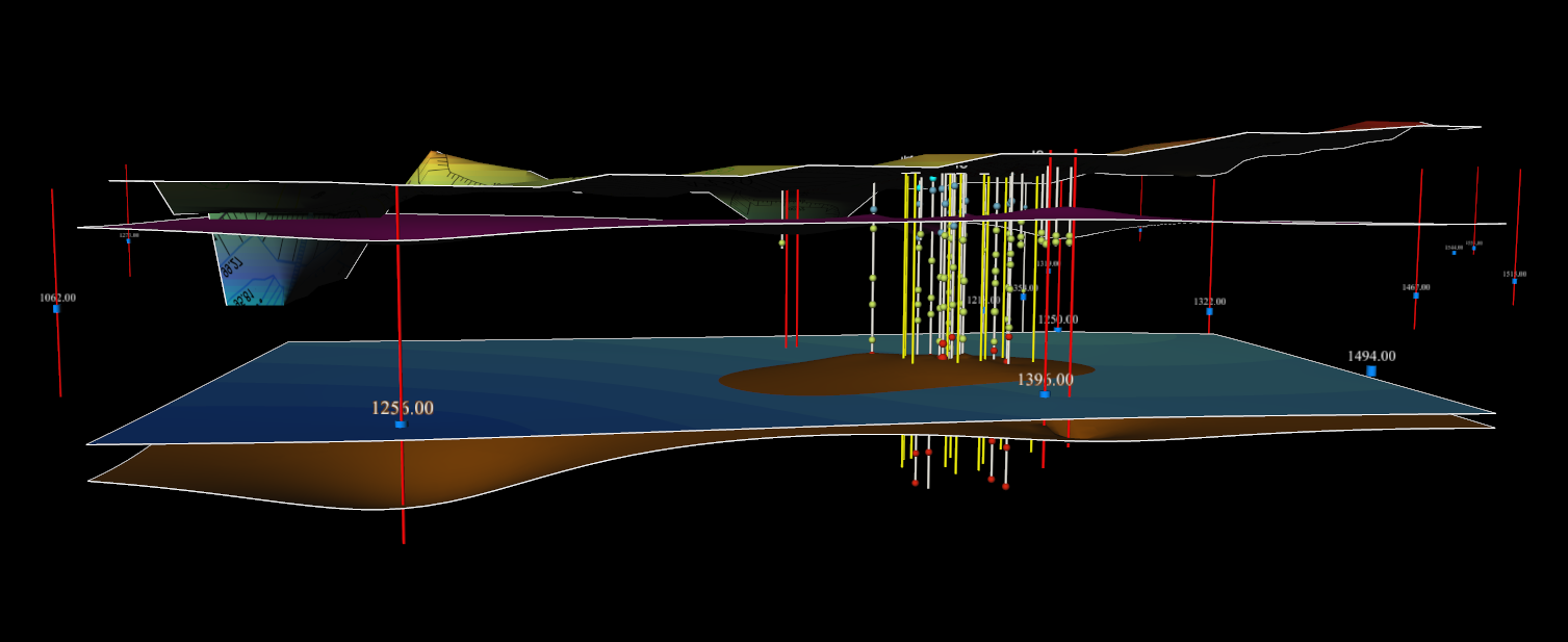
Geostatistical estimation of a contaminated area and its in situ remediated mass of chlorinated hydrocarbons
An original approach based on a double geostatistical modeling - before and after in situ remediation
Events
Tailored trainings in geostatistics applied to contaminated sites and urban soils
eOde proposes tailored trainings in geostatistics applied to contaminated sites and urban soils. In 2018 for example, eOde delivered an in-house 1-day course to the project managers of ADEME at Angers, while in 2014, [...]

4th national meeting on polluted sites and soil research – 26-27 November 2019 in Beffroi de Montrouge, portes de Paris
eOde collaborators were at the 4th national research meetings on polluted sites and soils organised by ADEME. Hélène Demougeot-Renard gave a presentation entitled "Geostatistical mapping of sanitary risks for brownfield conversion" and Sonia Tarnawski presented [...]
Services
Consulting offices, project owners, public agencies
Major benefits of geostatistics
Clients